American West
COMMENTARY
Manifest Destiny
The images in this spread, and the accompanying digital images of the progression of pages, are visual evidence of how Manifest Destiny—the doctrine that drove the colonization of the United States through Western territorial expansion and white supremacy—had taken hold culturally in America.
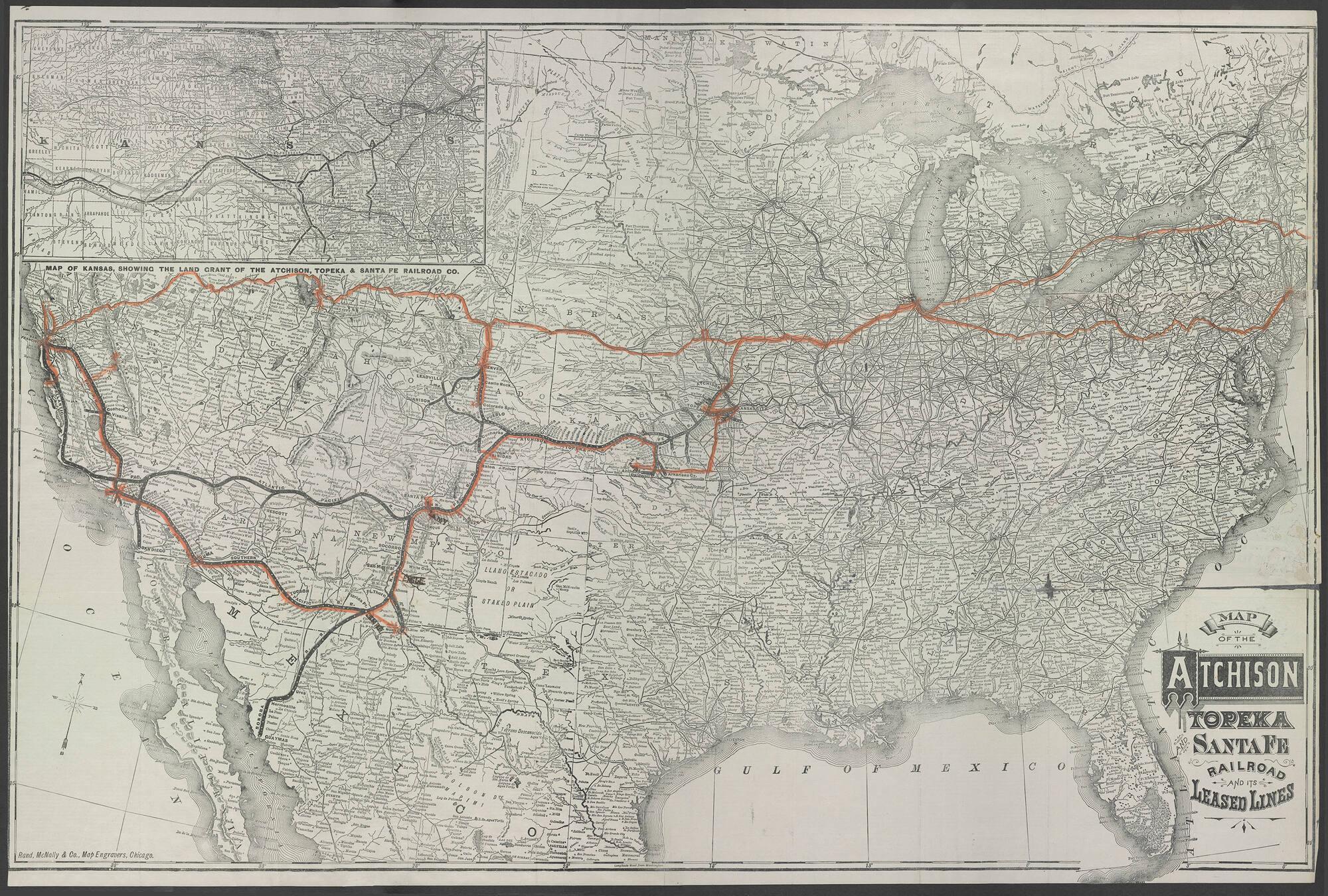
Read, McNally & Co., Map of the Atchison, Topeka, and Santa Fe Railroad, c. 1881
Map, enclosed in Travel Album: Northern and Eastern Europe, Russia, the United States, Mexico, and Cuba, 1867–1886
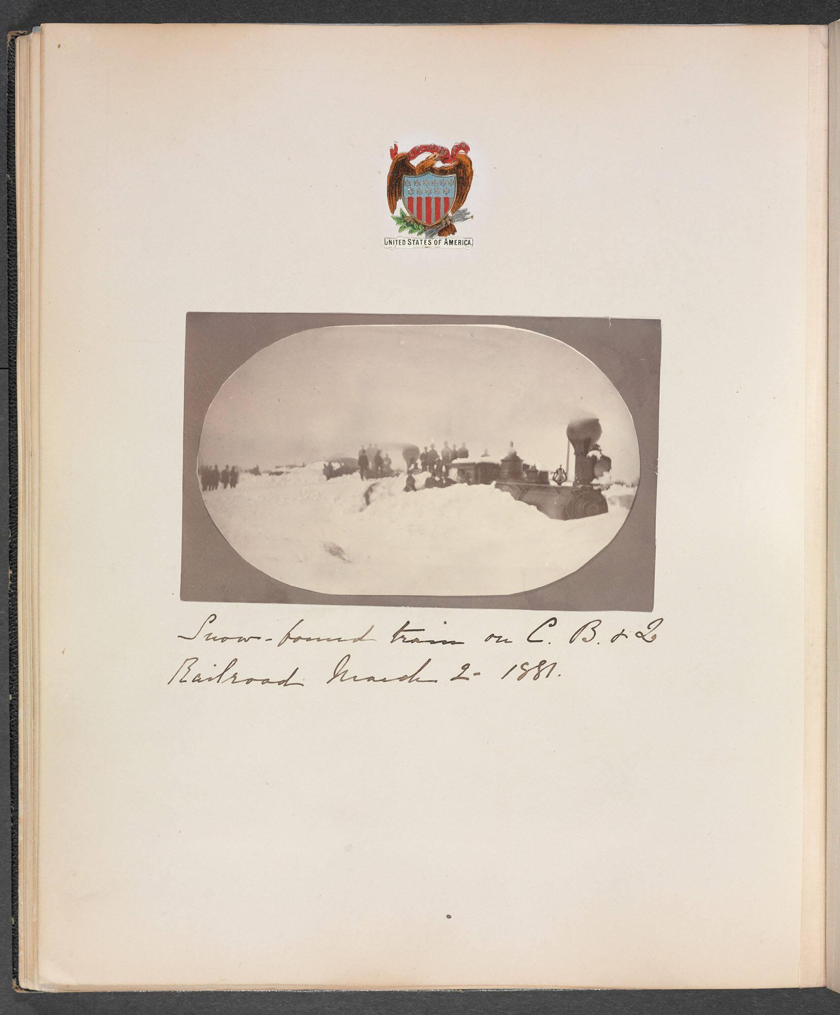
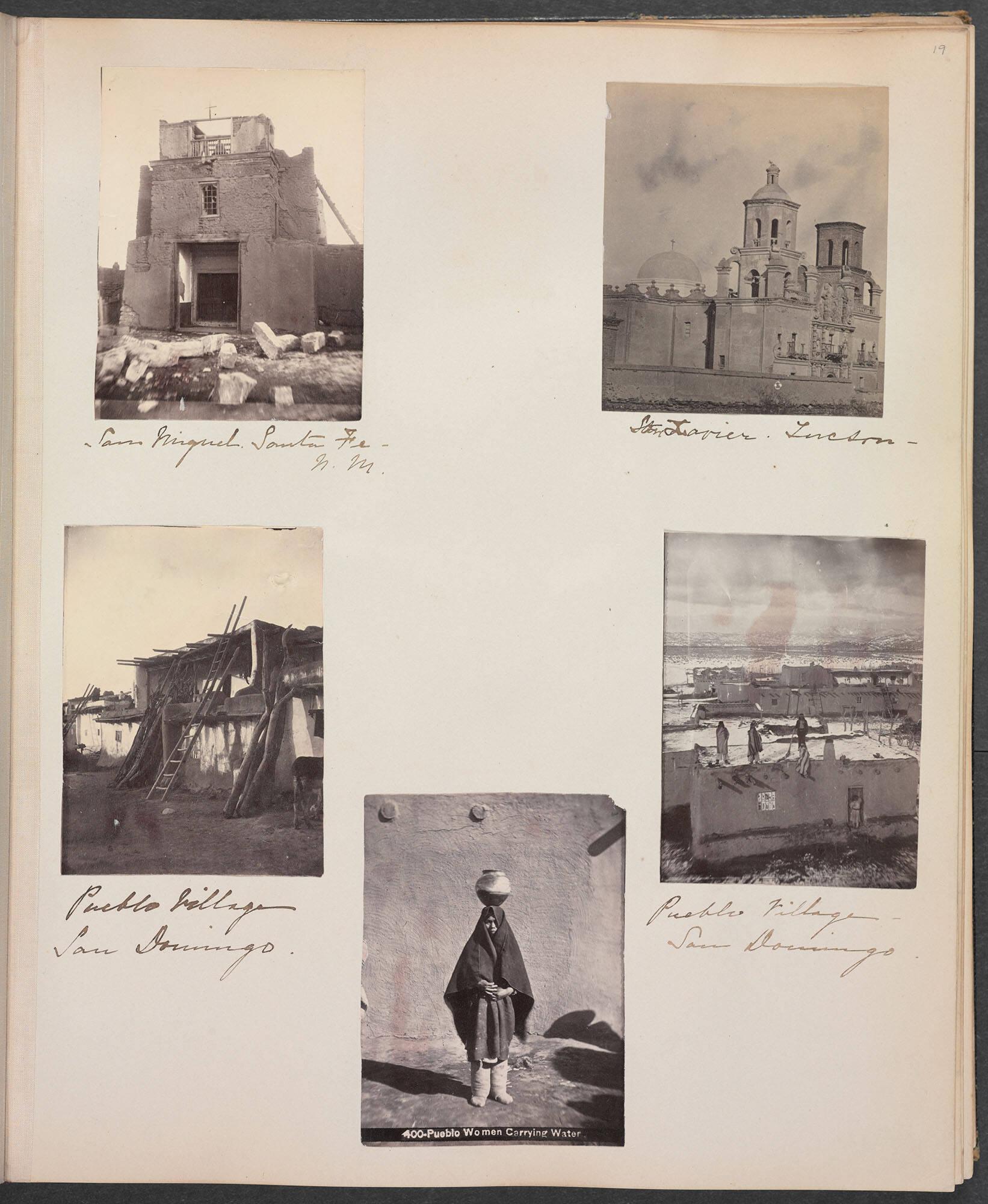
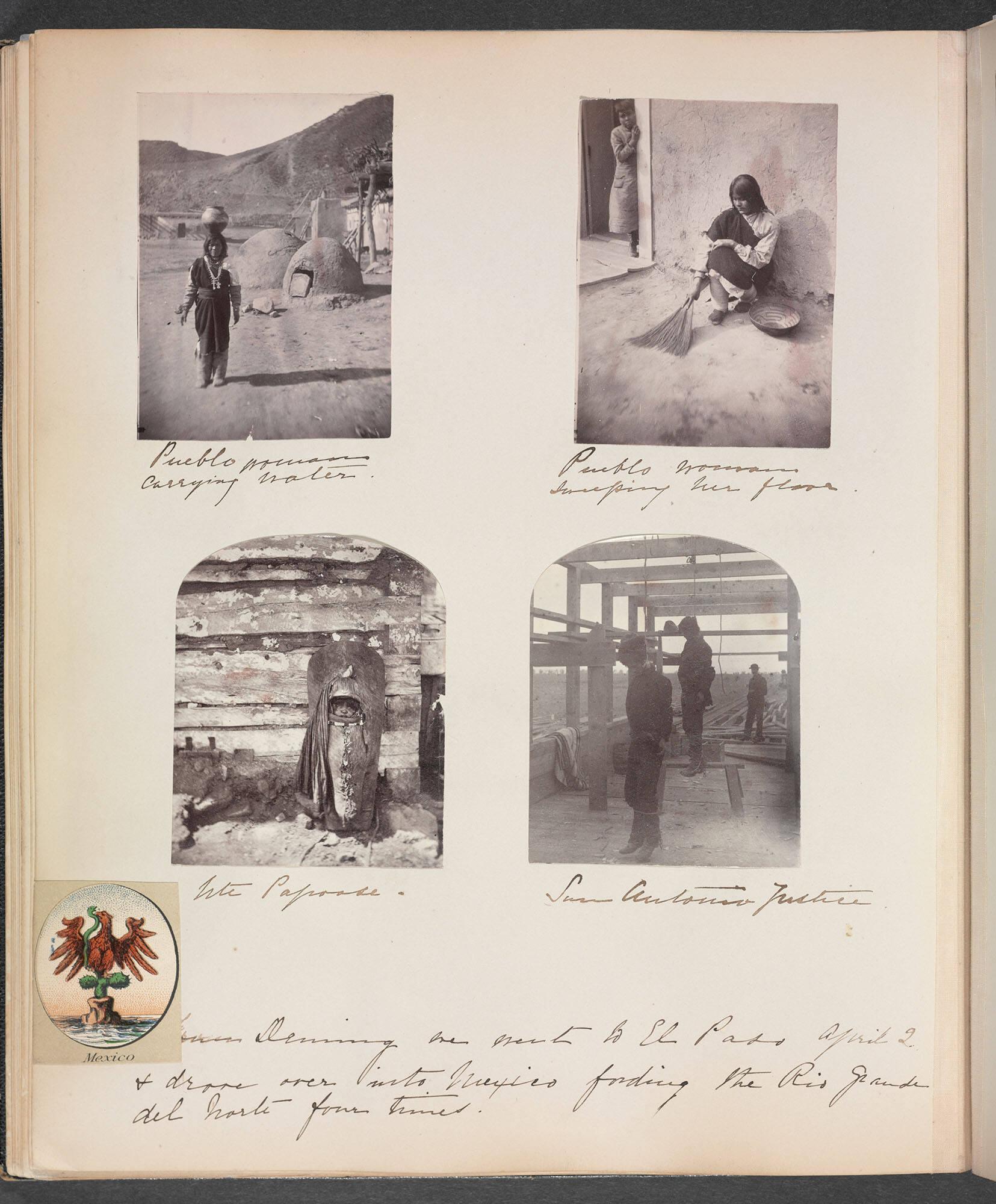
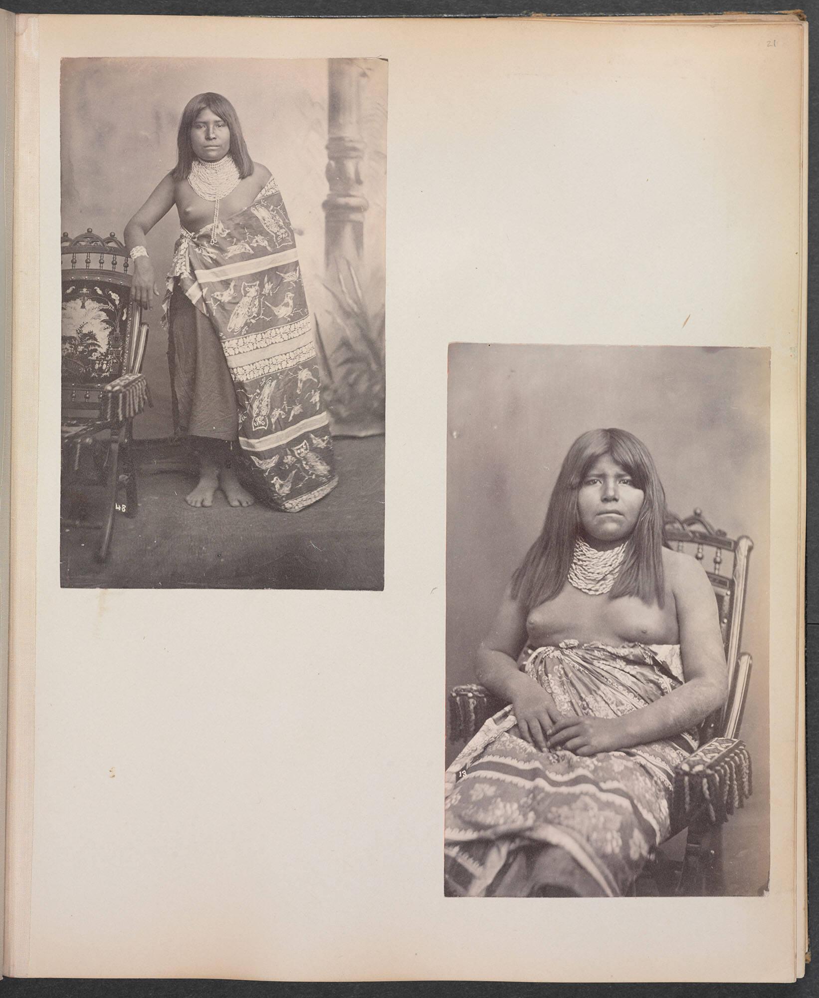
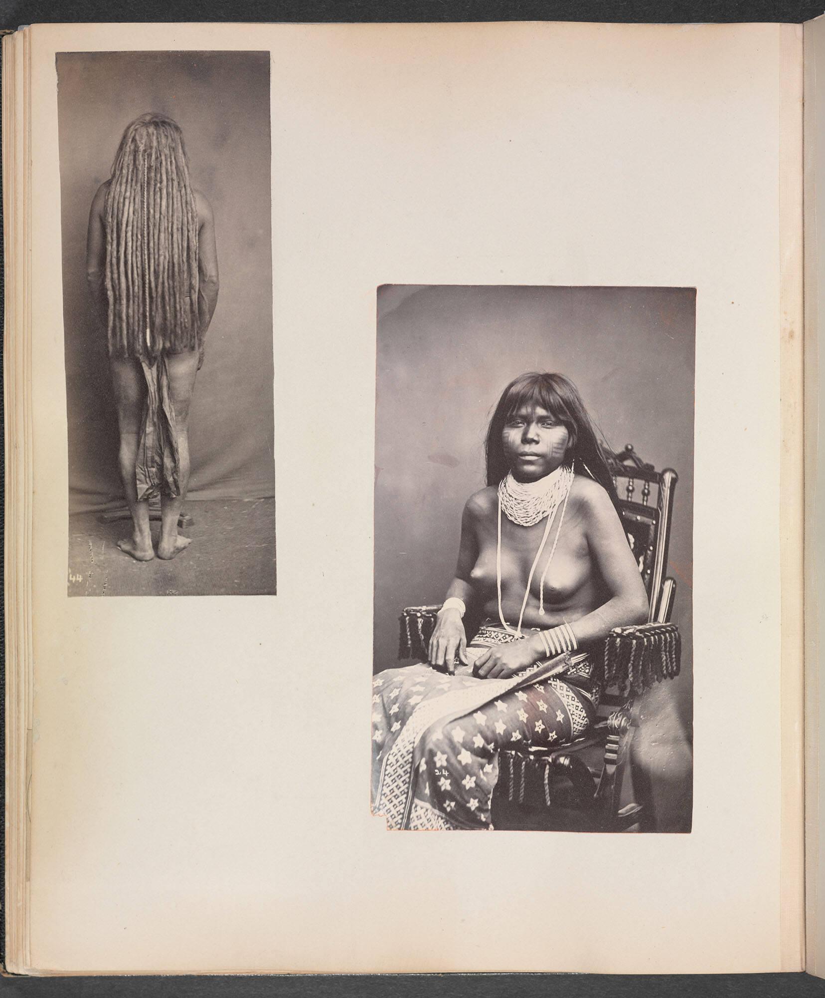
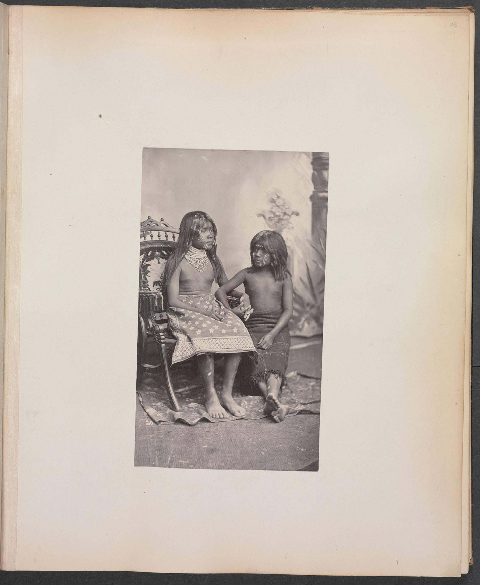
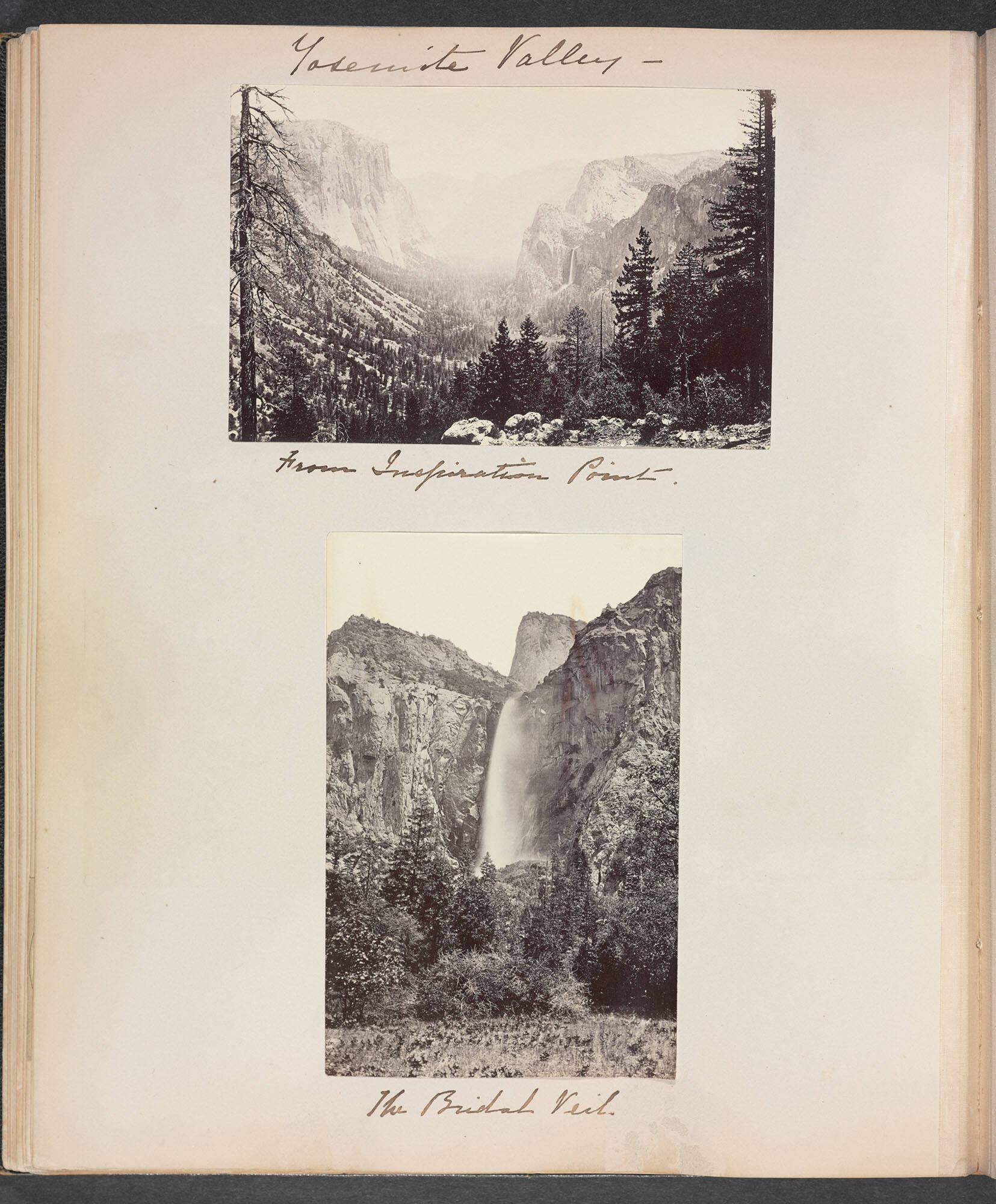
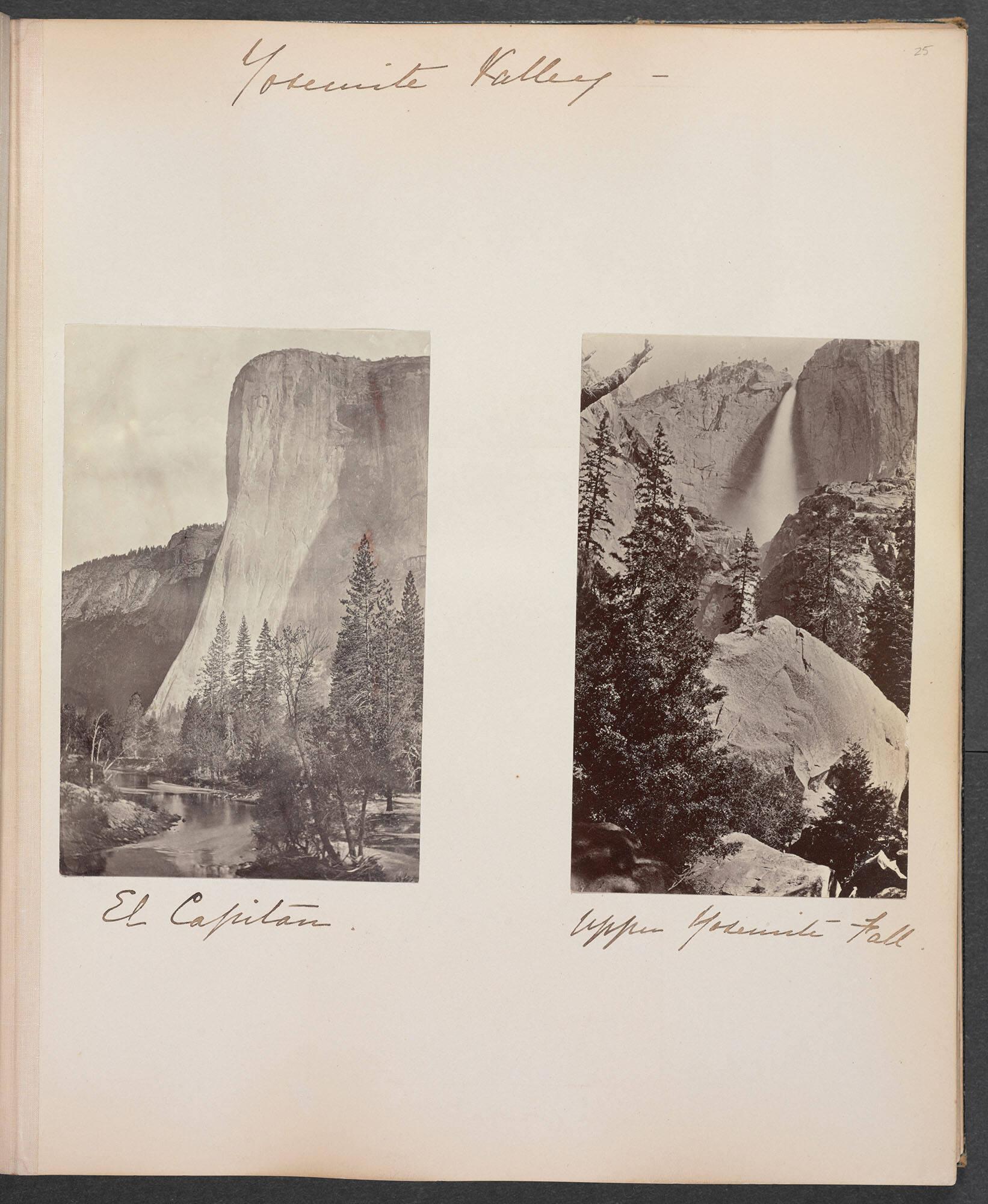
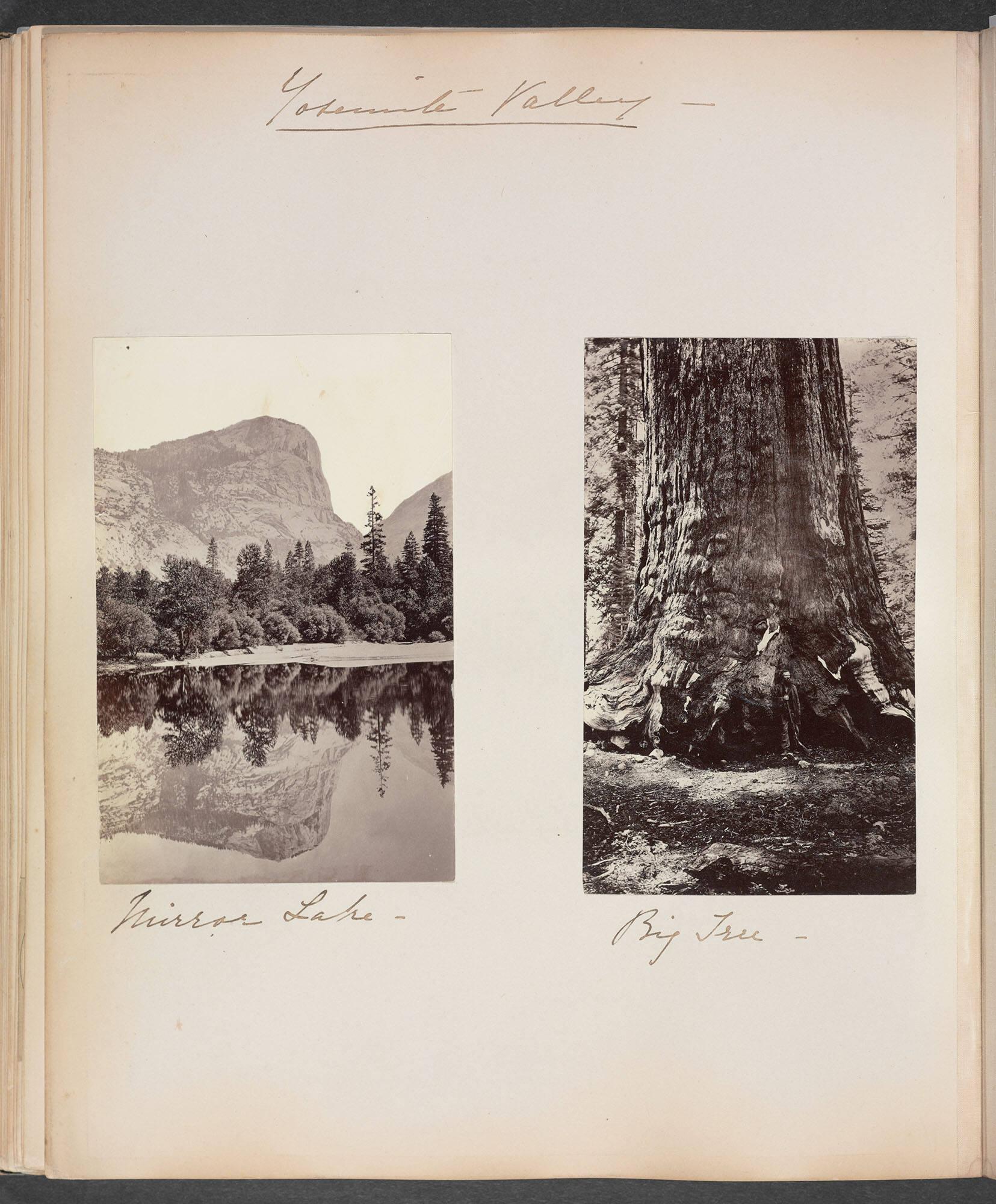
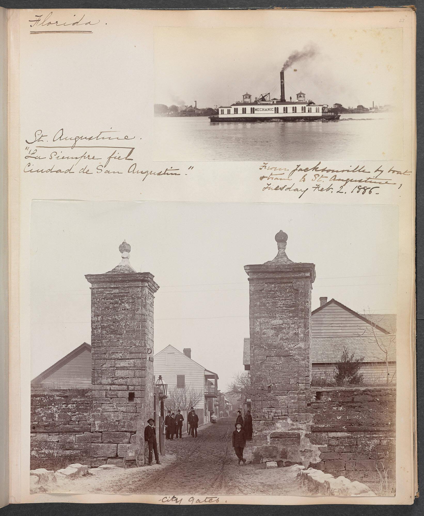
Beginning with an image of the railroad, the vehicle of settler colonialism, we follow Isabella Stewart Gardner’s travels through the lands of the Tohono O’odham, Santo Domingo Pueblo, and Ute peoples. The images show the Western tendency of “othering” and exoticizing colonized peoples. They include pueblo people in their homelands, pueblo and mission architecture, and ethnographic portraits of unidentified Indigenous people staged in settings that make them appear primitive. Disturbingly, this album contains an image of a hanging. Labeled in her hand as “San Antonio Justice,” the casual attitude with which Americans, like Gardner, regarded the violence and dehumanization underlying settler colonial systems is on full display. Following this, the landscapes of Yosemite are portrayed in a heavenly light, ethnically cleansed of the Indigenous peoples to whom the land belongs, hinting at the perceived divine right inherent to Manifest Destiny’s doctrines over Indigenous peoples of this land.
—Erin Genia, an enrolled member of the Sisseton-Wahpeton Oyate, Artist
Please note: This album contains images of violence. We choose to present an uncensored window into the objects in our collection. Please use your discretion when viewing the images below as well as the full album. Please see the publication, Fellow Wanderer: Isabella Stewart Gardner's Travel Albums for additional consideration of these images.
Read, McNally & Co., Map of the Atchison, Topeka, and Santa Fe Railroad, c. 1881. Map, enclosed in Travel Album: Northern and Eastern Europe, Russia, the United States, Mexico, and Cuba, 1867–1886.
This map was folded into the album documenting Gardner’s railroad trip across the United States with her husband. On it, Gardner documented their route. She also chose to cut out a piece of the map—specifically an early part of their journey from the Northeast to Chicago—to paste it into the album itself.